


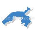
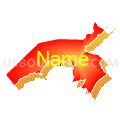
Love Chapel Voting District, Unicoi County, Tennessee
About
Outline

Summary
| Unique Area Identifier | 669868 |
| Name | Love Chapel Voting District |
| County | Unicoi County |
| State | Tennessee |
| Area (square miles) | 35.63 |
| Land Area (square miles) | 35.33 |
| Water Area (square miles) | 0.30 |
| % of Land Area | 99.15 |
| % of Water Area | 0.85 |
| Latitude of the Internal Point | 36.13092960 |
| Longtitude of the Internal Point | -82.45726240 |
Maps


Graphs
Select a template below for downloading or customizing gragh for Love Chapel Voting District, Unicoi County, Tennessee


Neighbors
Neighoring Voting District (by Name) Neighboring Voting District on the Map
- 01 Forest Hills Voting District, Greene County, TN
- 01 South Central School Voting District, Washington County, TN
- 04 Lamar School Voting District, Washington County, TN
- Voting District 04 RAM, Yancey County, NC
- 06 Embreeville Voting District, Washington County, TN
- Voting District 07, Mitchell County, NC
- Fishery Voting District, Unicoi County, TN
- Flag Pond Voting District, Unicoi County, TN
- Middle School Voting District, Unicoi County, TN
- Temple Hill Voting District, Unicoi County, TN
- Unicoi Voting District, Unicoi County, TN
Top 10 Neighboring County Subdivision (by Population) Neighboring County Subdivision on the Map
- District 5, Washington County, TN (13,168)
- District 2, Greene County, TN (10,094)
- District 9, Washington County, TN (9,413)
- District 3, Unicoi County, TN (6,873)
- District 1, Unicoi County, TN (5,727)
- District 2, Unicoi County, TN (5,713)
- Ramseytown township, Yancey County, NC (443)
- Poplar township, Mitchell County, NC (239)
Top 10 Neighboring Place (by Population) Neighboring Place on the Map
Top 10 Neighboring Unified School District (by Population) Neighboring Unified School District on the Map
- Washington County School District, TN (63,291)
- Greene County School District, TN (53,720)
- Unicoi County School District, TN (18,313)
- Yancey County Schools, NC (17,818)
- Mitchell County Schools, NC (15,579)
Top 10 Neighboring State Legislative District Lower Chamber (by Population) Neighboring State Legislative District Lower Chamber on the Map
- State House District 84, NC (65,274)
- State House District 6, TN (63,258)
- State House District 5, TN (59,380)
Top 10 Neighboring State Legislative District Upper Chamber (by Population) Neighboring State Legislative District Upper Chamber on the Map
- State Senate District 1, TN (185,350)
- State Senate District 3, TN (180,403)
- State Senate District 47, NC (168,288)
Top 10 Neighboring 111th Congressional District (by Population) Neighboring 111th Congressional District on the Map
- Congressional District 11, NC (703,606)
- Congressional District 10, NC (689,468)
- Congressional District 1, TN (684,093)
Top 10 Neighboring Census Tract (by Population) Neighboring Census Tract on the Map
- Census Tract 910, Greene County, TN (7,790)
- Census Tract 618, Washington County, TN (6,775)
- Census Tract 619.01, Washington County, TN (6,752)
- Census Tract 802, Unicoi County, TN (6,395)
- Census Tract 803, Unicoi County, TN (5,138)
- Census Tract 9604, Yancey County, NC (4,304)
- Census Tract 804, Unicoi County, TN (4,112)
- Census Tract 801, Unicoi County, TN (2,668)
- Census Tract 9501, Mitchell County, NC (2,479)
Top 10 Neighboring 5-Digit ZIP Code Tabulation Area (by Population) Neighboring 5-Digit ZIP Code Tabulation Area on the Map
- 37659, TN (27,585)
- 28714, NC (16,753)
- 37650, TN (12,750)
- 37641, TN (8,567)
- 37692, TN (4,770)
- 28740, NC (1,364)
- 37657, TN (972)